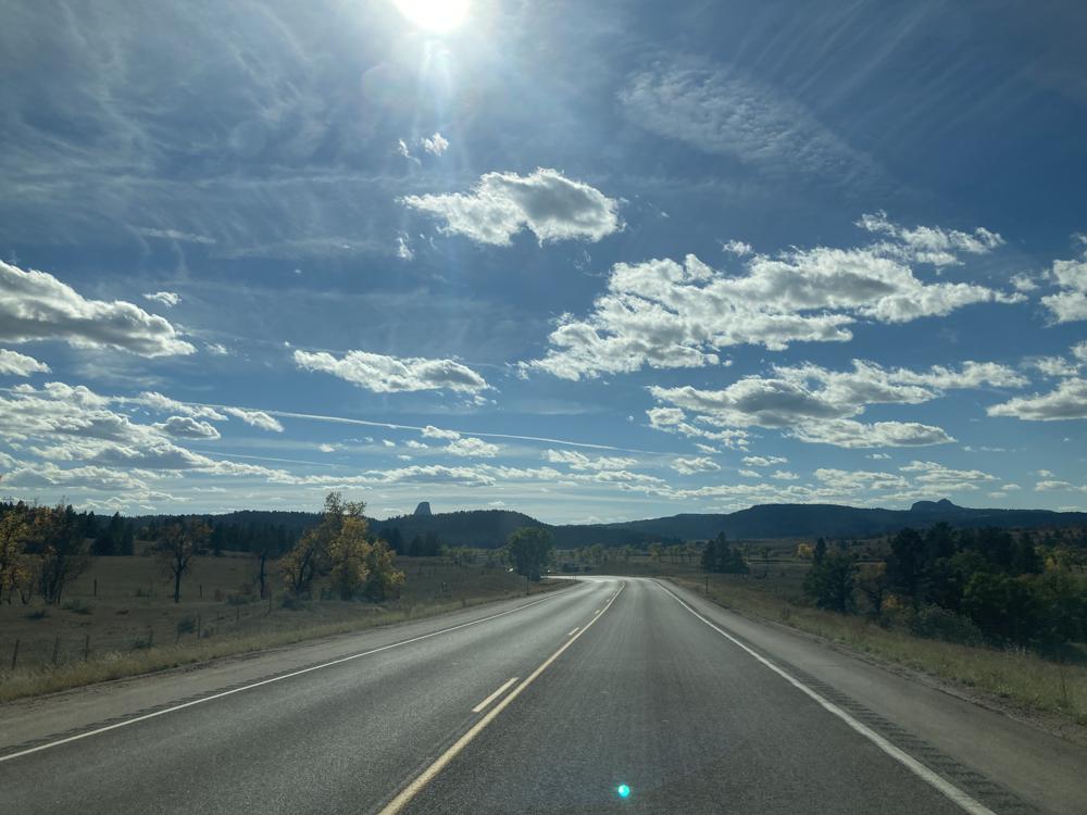
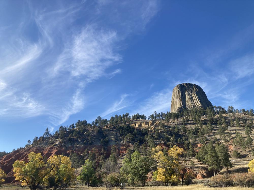
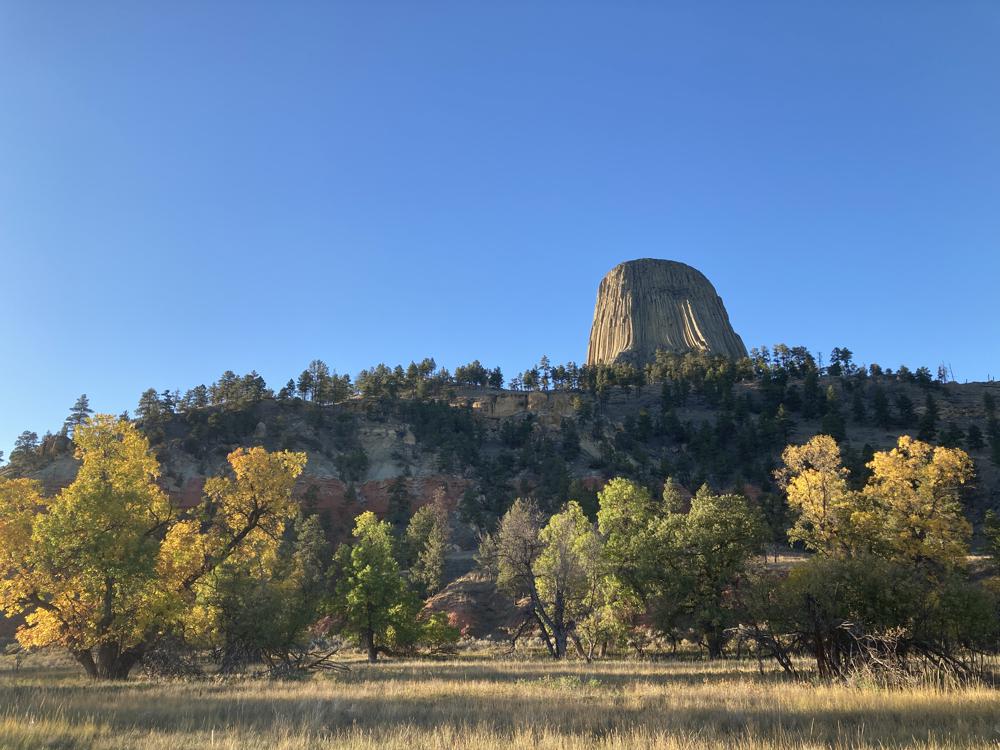
I left the Black Hills National Forest in Wyoming this morning. Here I can see my destination ahead in the distance: Devils Tower.
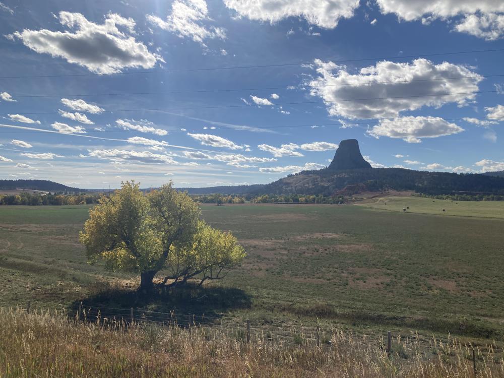
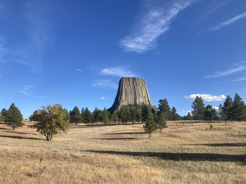
I had to stop at the side the road and take this photo across a farm pasture.
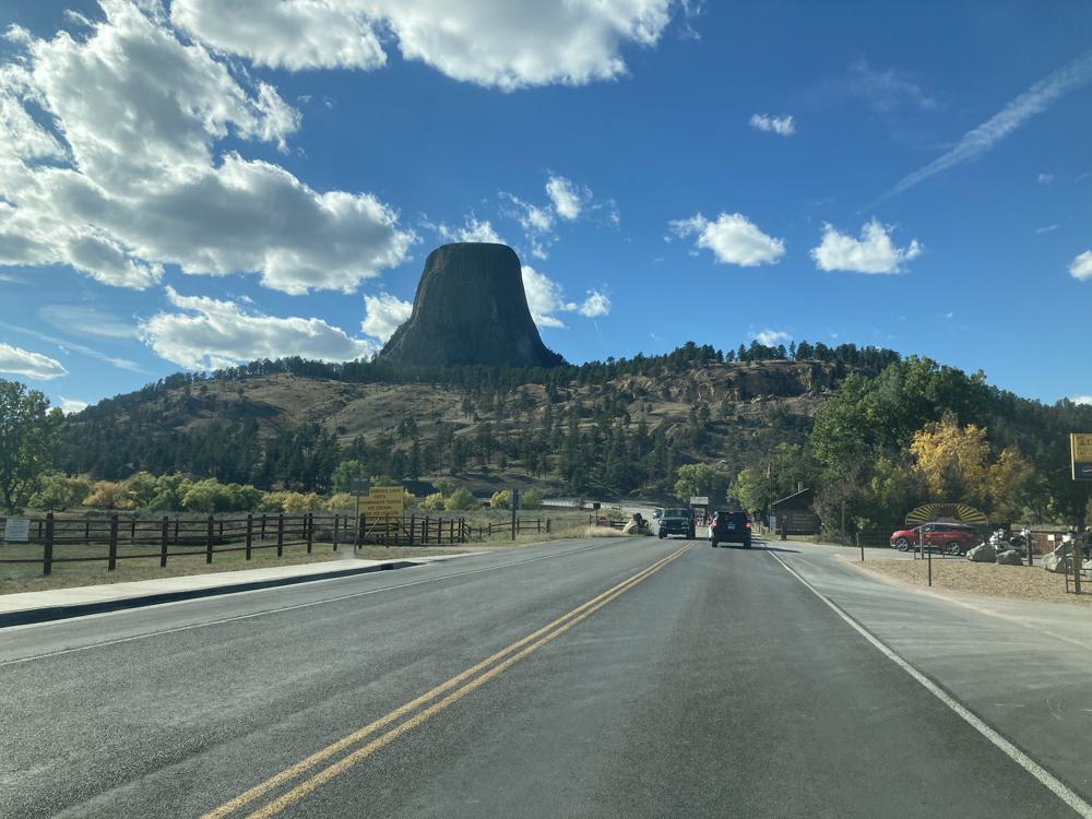
This the the view from the entrance of the National Monument.
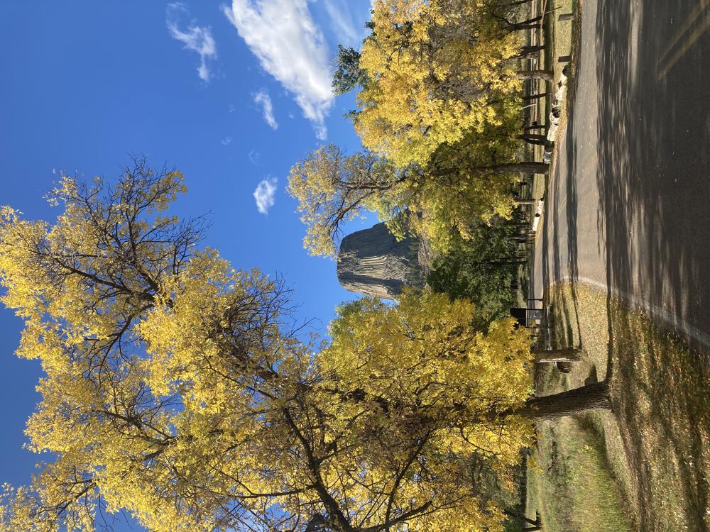
Here is a view from the road leading to the very nice campground inside Devil's Tower National Monument.
After choosing my campsite and parking, I decided to ride my bike up to the base of the tower.
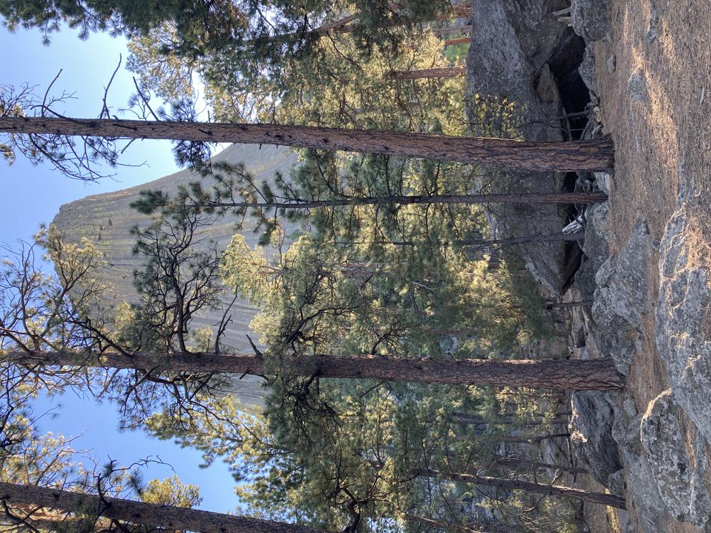
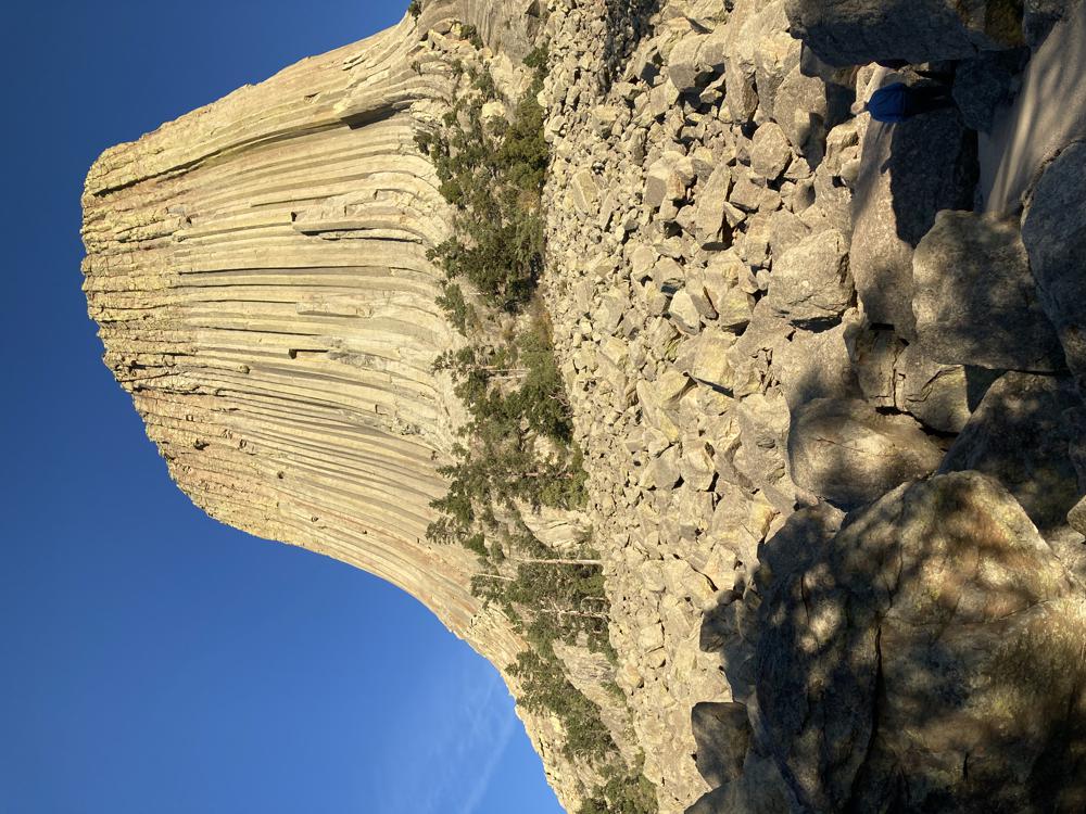
It was more uphill climbing on the bicycle then I thought , but these views on they way were worth it.
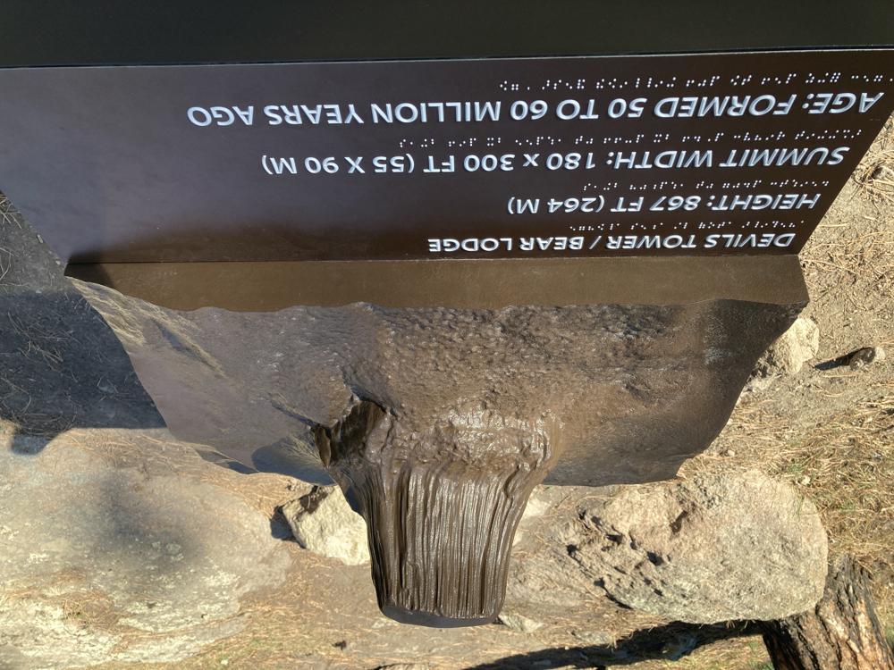
I got to the visitors area at the base of the tower and locked my bike up to have a look around on foot. This sign reads:
- Devils Tower / Bear Lodge
- Height: 867 ft (264 M)
- Summit Width: 180 x 300 ft (55 x90 M)
- Age: Formed 50 to 60 Millions years ago
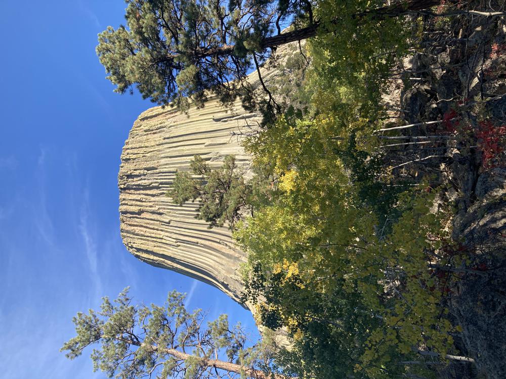
I decided to take the approximately 1.5 mile paved path around the tower. Tomorrow I will run from camp to and around the longer Red Bed Trail.
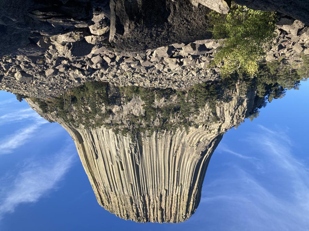
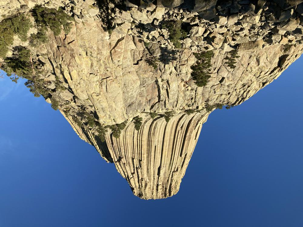
A majestic view.
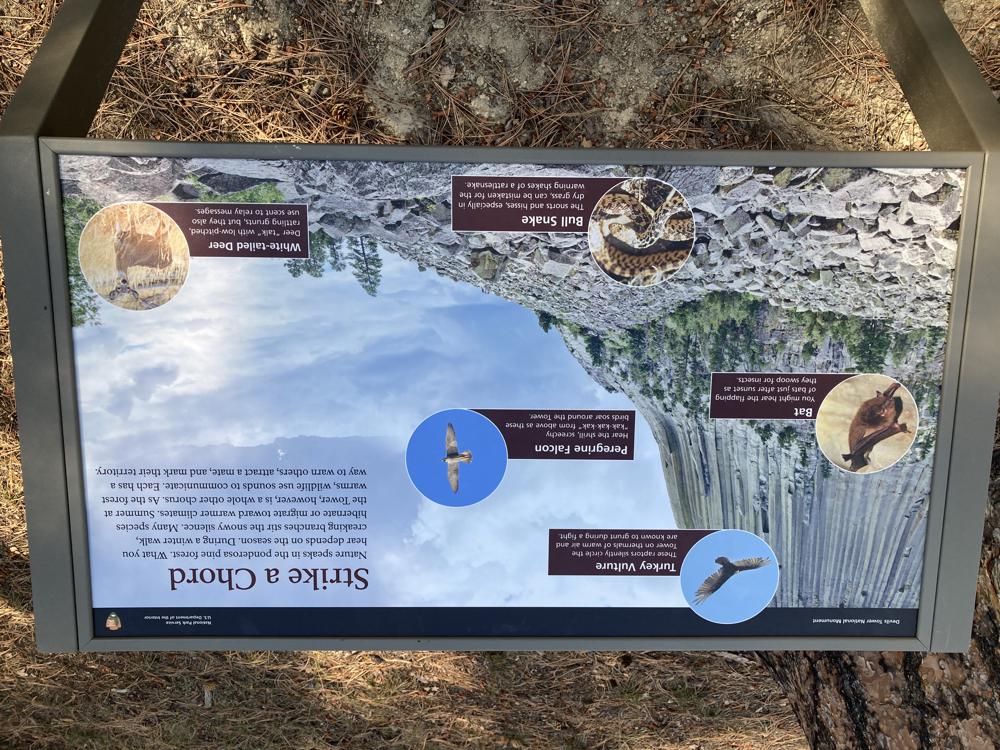
There were signs describing the nature and geology along the trail. This one reads:
"Nature speaks in the ponderosa pine forest. What you hear depends on the season. During a winter walk, creaking branches stir the snowy silence. Many species hibernate or migrate toward warmer climates. Summer at the Tower, however, is a whole other chorus. As the forest warms, wildlife use sounds to communicate. Each has a way to warn others, attract a mate and mark their territory."
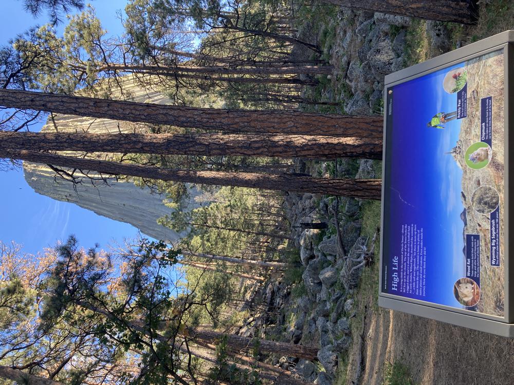
Darn I can not read this sign from the photo. But I think it is talking about the animal and plant life that live on top of the tower.
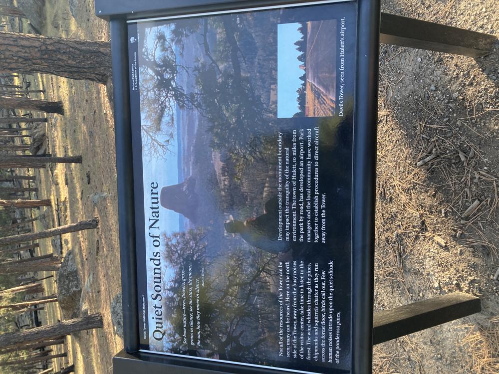
This one reads:
"Not all of the resources of the Tower can be seen; many can be heard. Here on the north side of the Tower, away from the busy noises of the visitors center, take time to listen to the forest. The wind whistles through the pines, chipmunks and squirrels chatter as they run across the forest floor, birds call out. Few human noises intrude upon the quiet solitude of the ponderosa pines.
Development outside the monument boundary may impact the tranquility of the natural environment. The town of Hulett, 10 miles from the park by road, has developed an airport. Park managers and the local community have worked together to establish procedures to direct aircraft away from the Tower."
It was nice just to stand, stair, and listen in this peaceful awe inspiring environment.
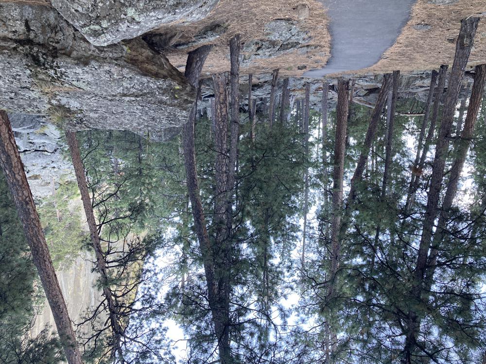
This is a view of the paved path around the monument.
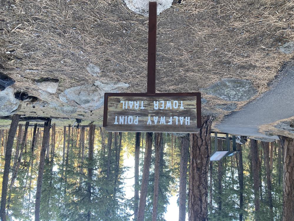
Half way around from the visitors center parking lot.
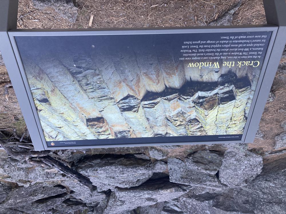
This sign reads:
As the sun rises in the east, long shadows cast a deeper view into the Tower. The Window is on of the Tower's most distinctive features, a 300-foot alcove above the boulder field. The Window cracked open as a tall stone pillars topples from the Tower. Look for nature's brushstrokes in the shades of orange and green lichen that now cover much of the Tower.
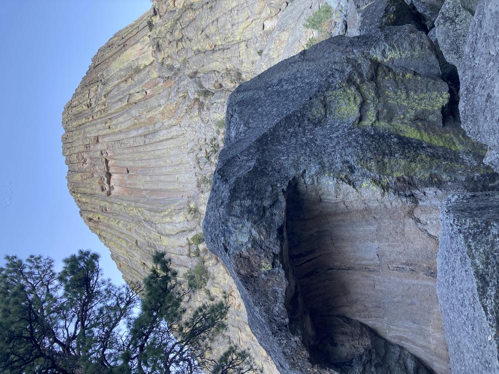
A boulder in the "boulder field" below the tower.
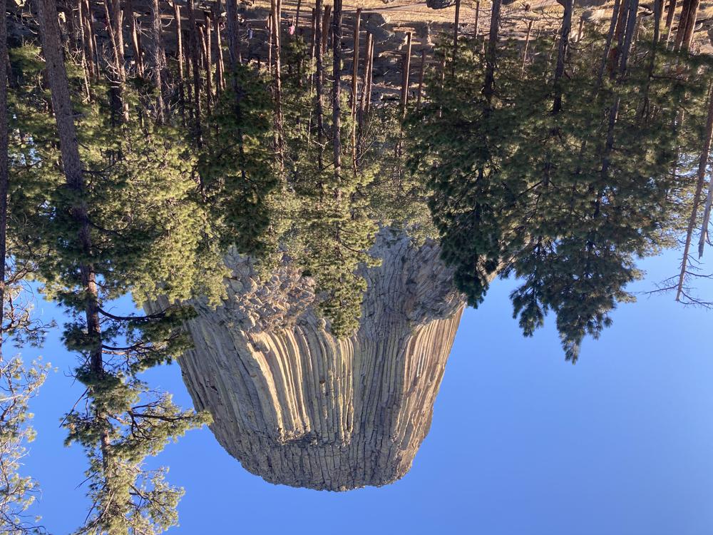
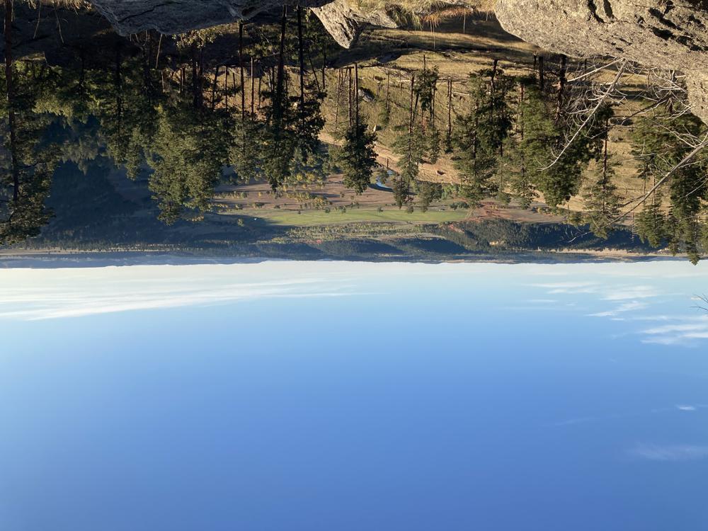
A more distant view with pine trees in the foreground.
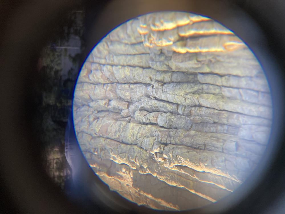
I put my binoculars up to my camera lens to see if I could take a picture of the climbers. Can you spot the climber?
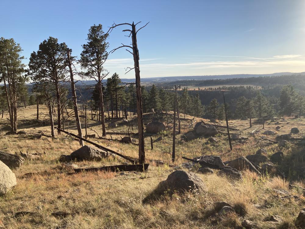
The view looking away from the Tower.
Amazing view. And yes there are climbers up there right now but they are to small to see.
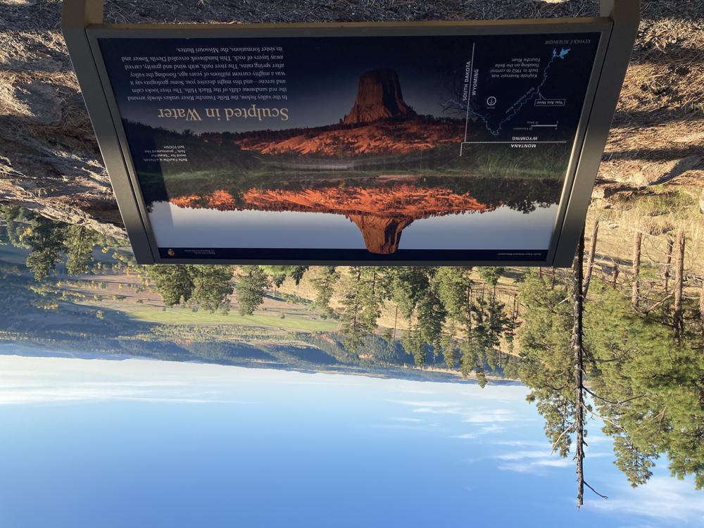
This sign reads:
In the valley below, the Belle Fourche River snake slowly around the red sandstone cliffs of the Black Hills. The river looks calm and serene--and might deceive you. Some geologists say it was a mighty current millions of years ago, flooding the valley after spring rains. The river rush, with wind and gravity, carved away layers of rock. This handiwork revealed Devils Tower and its sister formations, the Missouri Buttes.
A view of the valley, with the Belle Fourche River.
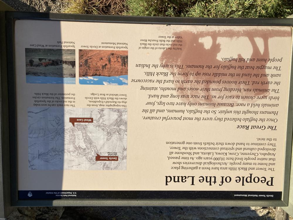
This sign reads in part:
The Tower and Black HIlls area have been a gathering place and home to many people. Archeological discoveries show that native people lived here 10,000 years ago. As time passed, Arapaho, Cheyenne, Crow, Kiowa, Lakota, and Shoshone all developed curltural and spiritual connections with the Tower. They continue to hand down their beliefs from on generation to the next.
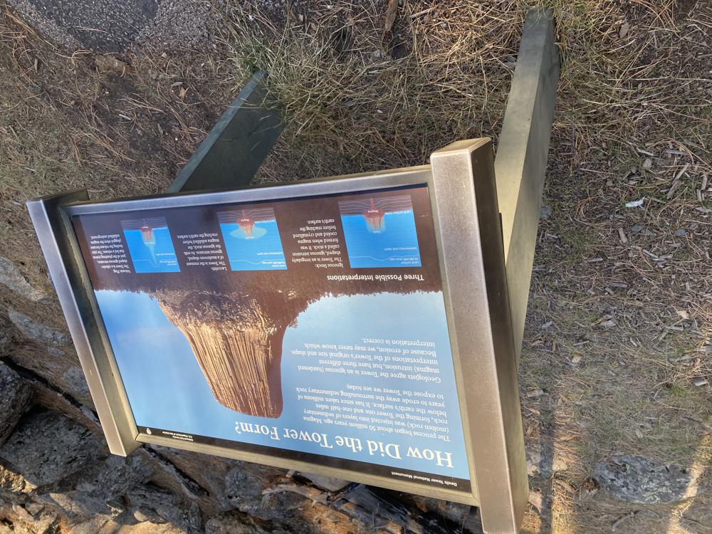
This sign read in part:
The process began about 50 million years ago. Magma (molten rock) was injected into layers of sedimentary rock, forming the Tower one and one-half miles below the earth's surface. It has since taken millions of years to erode away the surrounding sedimentary rock to expose the Tower we see today.
Geologists agree the Tower is an igneous (hardened magma) intrusion, but have three different interpretations of the Tower's original size and shape. Because of erosion, we may never know which interpretation is correct.
Another majestic view with a man standing in the foreground for scale.
From the bike ride back to my campground.
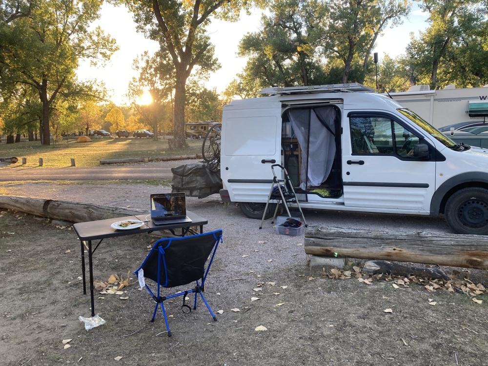
Finally back to camp and time for dinner and watch some Norwegian noir crime drama. Looking forward to my run around the tower tomorrow on the longer Red Bed's Trail.